

Bentonville-based Progressive Trail Design has submitted a 50% complete master plan proposal for the development of Bob Boyer Park in Midland.
INTRO
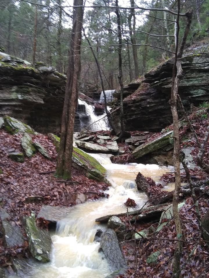
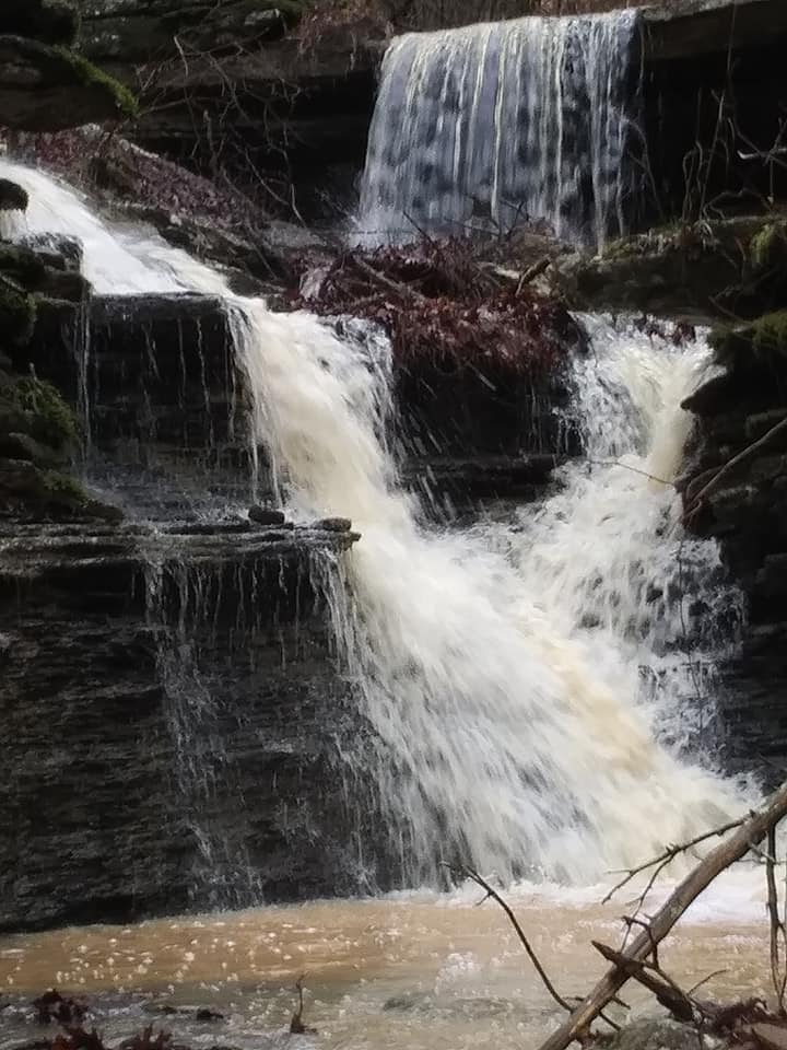
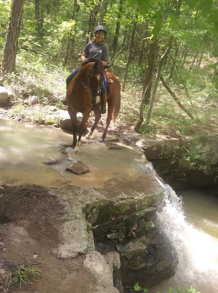
Located in South Sebastian County, Bob Boyer Park is a hidden gem roughly 30 minutes from Fort Smith. The nearly 450-acre property has a variety of terrain, rare flora and fauna, and multiple waterfalls. Natural glades scatter the site along with beautiful rock formations. The aging trails make it hard to enjoy the site, hindering its amazing potential to be among the most beautiful places to enjoy outdoor recreation in Arkansas.
SITE HISTORY
Bob Boyer Park and the surrounding areas are laden with history dating back to the original settlement in the 1860’s. One of the most notable and documented figures of this era is Amos Johnson, the original and only homesteader on the site. Amos was the postmaster for Midland and had approximately 20 acres of cleared land that has since been
reclaimed by nature. Remnants of the homestead can still be found on-site in the stacked stone foundations and fence lines. The town of Midland also has an interesting history that includes the rise and fall of the coal industry in western Arkansas and eastern Oklahoma. Formerly known as Burma, the name changed to Midland when The Midland Railroad Co. laid the first tracks connecting the town to the nation’s railroad system. The town is said to have peaked in population around 1910 with over 3,500 residents, dwarfing the 2010 census data showing only 325 permanent residents.
EXISTING CONDITIONS
The current state of Bob Boyer Park is fair, with open space and parking limited to the southeast corner. Trail markers and signage are sparse, and the proliferation of hiking and horse trails makes navigating the site difficult. Users must travel deep into the property and then backtrack to get to several key points of interest. Currently all users (OHV, Equestrian, Hiking, and Biking) share the same trails. As a result, the existing state of the trails varies greatly from being well maintained to extremely steep eroded washes. The difficulty level of the trail system lacks consistency, with some trail sections starting with very relaxed grades that turn into steep climbs.
A PTD team spent two days exploring the trails. Accompanying them, Jay Randolph from Sebastian County Parks. “We
spent the day tracking along the main trails through the site and located a few of the larger waterfalls and sensitive areas. We climbed up to Annetta’s Overlook and the uppermost waterfall. The recent rainfall made the creeks and waterfalls a beautiful experience. On the second trip down to Bob Boyer Park, the PTD Team again joined Jay
for the day and dove deeper into the site. Exploring more of the northern portions of the property, we wanted to track as many of the known trails as possible. Locating additional points of interest, this second outing allowed us to hone in on some of the problematic areas and trails we didn’t get to look at in-depth on the first trip.”
PTD FINDINGS
The most obvious thing we found is the incredible beauty and potential of this site. Scattered with waterfalls, natural glades, and rare flora and fauna only located in this small region of the United States, it is clear that extra precaution and care should be taken to preserve the significant and sensitive areas of this site. We found that the lack of a consistent trail experience, appropriate wayfinding, and educational signage diminishes a user’s interaction with the site.
CONSIDERATIONS
Bob Boyer Park is a very unique project for PTD. The beautiful flora and fauna, natural glades, grade changes, and spectacular waterfalls on-site call for a different approach than we would normally take. Focusing more on preserving and highlighting the sensitive and significant areas of the site, our goal will be to create a National Park feel on a smaller scale. Proposing the appropriate amount of trail, the use of educational signage and wayfinding, and best trail construction practices will make this a world-class park and put the spotlight on this hidden gem of western Arkansas. Bob Boyer Park is key to providing trails for an underserved and underrepresented part of the state. With that in mind, we are proposing one main access trail through the property and smaller more intimate trails to get users to the scenic destinations on the property. Following best practices, horse-optimized and bike-optimized trails should be separated from other users and both bike and horse riders must dismount before entering the sensitive ecological zones.
The following outlines PTD’s priorities regarding the aspects of design and construction:
DESIGN
UNIFIED VISION: We will work closely with the key stakeholders to create a unified vision.
CONSERVATION: Through careful site assessment, we will identify areas of interest and concern.
We will synthesize our design to celebrate, not compromise, key areas of interest.
ACCESSIBILITY AND PROGRESSION: To ensure an accessible and progressive riding experience, this
project will service a wide variety of users and skill levels. From small tots to advanced riders,
there will be distinct opportunities for adventure through different trail experiences.
LONGEVITY: We will work with the existing terrain and environment to achieve a timeless design
that lasts for generations to come. Our attention to details inform the design, park flow and
proper drainage and will equip the site to handle the most adverse of natural conditions.
CONSTRUCTION
MINIMAL DAMAGE: PTD prioritizes the sustainability for all projects. We will disturb as little of
the natural environment as possible.
EROSION CONTROL AND DRAINAGE: PTD places major emphasis on preventing erosion, cutting
down maintenance costs, and ensuring proper drainage of trail and amenities. We will utilize
natural stone, rock, and rip rap erosion control methods, as well as piping to balance and enhance
this drainage.
ACCESS: By finding the most sustainable locations, we will establish temporary construction
roads* and staging areas to house equipment throughout the project. *Where applicable — some
projects will not require
TIME MANAGEMENT: We will utilize project management software to meet deadlines and maintain
efficient construction practices.
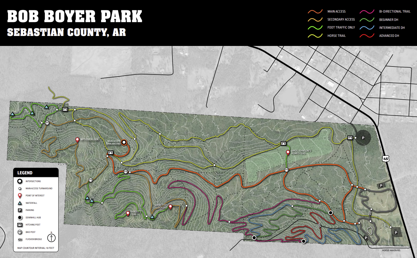
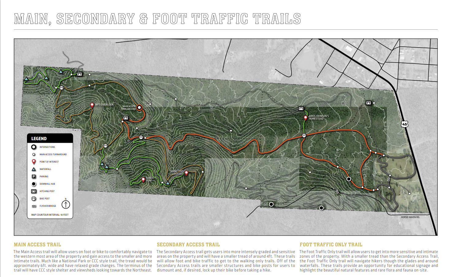
MAIN ACCESS TRAIL
The Main Access trail will allow users on foot or bike to comfortably navigate to the western most area of the property and gain access to the smaller and more intimate trails. Much like a National Park or CCC style trail, the tread would be approximately 6ft. wide and have relaxed grade changes. The terminus of the trail will have CCC style shelter and viewsheds looking towards the Northeast.
SECONDARY ACCESS TRAIL
The Secondary Access trail gets users into more intensely graded and sensitive areas on the property and will have a smaller tread of around 4ft. These trails will allow foot and bike traffic to get to the walking only trails. Off of the Secondary Access trails are smaller structures and bike posts for users to dismount and, if desired, lock up their bike before taking a hike.
FOOT TRAFFIC ONLY TRAIL
The Foot Traffic Only trail will allow users to get into more sensitive and intimate zones of the property. With a smaller tread than the Secondary Access Trail, the Foot Traffic Only trail will navigate hikers though the glades and around waterfalls. These trails provide an opportunity for educational signage and highlight the beautiful natural features and rare flora and fauna on-site.
BIKE
Users on bicycle will be allowed access on bike-specific trails to the southeast as well as the Main and Secondary trails. Riders will have stopping points to dismount, hitch (and lock if needed) their bikes up, and hike the foot traffic trails. The bike-specific zone to the southeast provides users a variety of loops, terrains, and difficulty levels. A proposed paved loop similar to the existing one but with some fun “pump zones” incorporated and a skills loop will allow riders to develop their skills from beginner to expert.
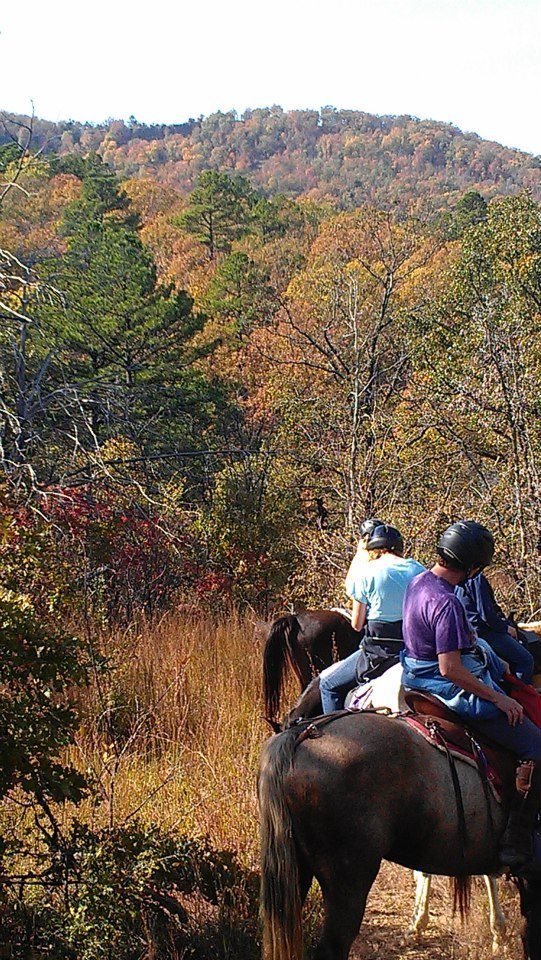
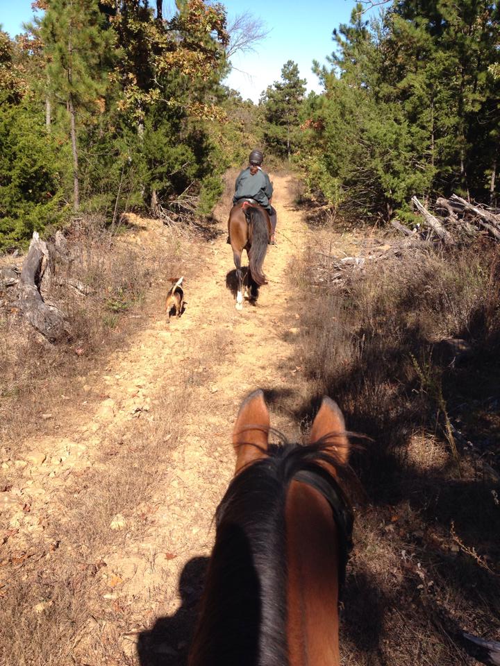
HORSE
The Horse Trails will provide equestrian riders an opportunity to get deep into the property and ride on a variety of terrain. Along the horse trail there will be stopping points at which they can dismount and hitch their horses to a post to further explore on foot. If approved, a connection to Annetta’s property would allow for the trails to be extended to the northwest.
“Progressive Trail Design is excited to work with Sebastian County on Bob Boyer Park. We strongly believe that Bob Boyer Park has an abundance of potential and we look forward to making sure it is used in the best way possible.”
Sebastian County Parks Administrator, Jay Randolph, stated that the planning is in very early stages. A stakeholders group continues to make recommendations for the Bob Boyer Park trail development. Those groups are comprised of three to four representatives with interests in mountain biking, equestrian and hiking. Members of the steakholders group are based locally and regionally.
“This could be really good for Midland,” stated Randoph. “The economic impact will be great for the area.”
Randolph stated that as a master plan continues to develop, the parks department will be seeking ways to fund the project.
(photos courtesy of Progressive Trail Design and Annetta Tinsman)


